|
 |
|
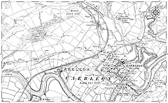
| Detailed
Ordnance Survey map. Every town in England and Wales available.
Maps date back to between 1860 and 1910. |
|
| Simply click on a map to visit the relevant page on the Francis Frith website. |
|
|
|
|
 |
|
|
|
|
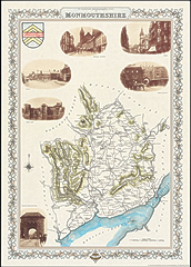
| Reproduction
of hand tinted original map published in Samuel Lewis's
1831 'Topographical Gazetteer' decorated in the margins
with sepia photographs of the county - specially chosen
from The Francis Frith Collection. |
|