Dorian Turner (previously Dorian Penn) kindly sent this photo and accompanying description.
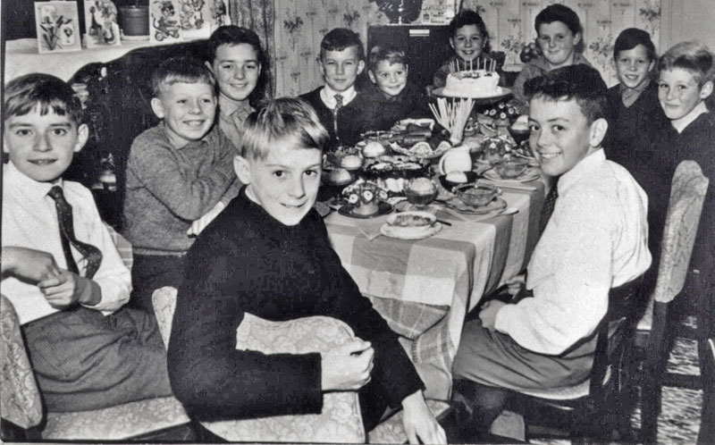
"This photo shows a gang of friends and family celebrating Tommy Putnam’s 10th birthday in 1961. He was living in a 'prefab' at the top end of Lodge Hill, where the school is now situated. In those days we were made to wear our 'Sunday Best' to attend. In fact mothers wouldn’t let you go until your were scrubbed clean to within an inch of your life and after your ears, teeth, shirt collar, cuffs and shoes had all passed due scrutiny.
As you can see in those days tea cakes, Lyons chocolate rolls, trifle, jelly and tiny cocktail sausages on a stick were the order of the day which it was quite a luxury to all of us...even using ‘straws’ with our orange squash was a big treat.
Going around the table clockwise and starting with the nearest boy we have - Kevin Murray : Clifford Goodwin: Alan Swales : Dorian Turner ( formerly Penn) : Roger Waggett : Terry Putnam : Tommy Putnam (Birthday Boy) : ? : Jimmy Putnam : Garry Conway : Mark Turner (formerly Merlin Penn)
Several years later my mother remarried a Mr Turner and my late brother and I changed our surname from Penn to Turner out of respect.
I’d like to acknowledge and thank Kevin Murray for this picture which I believe was passed on to my late mother, it would be really great to see other similar celebrations like this."
To email Dorian click
here. |