The
first representation we have found of the market hall is on Thomas
Thorpe's map of 1752 - A plan of the lands
belonging to the Right Honourable the Earl of Powis in the manor
of Liswerry and Libennith in the parishes of Christchurch, Caerleon,
Llanvrechea, etc. We have redrawn the
part of the map which is of interest to us here with the market
hall marked in red. (The position of the bridge will help with orientation.)
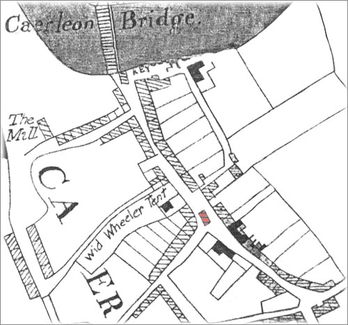
A redrawing of
Thomas Thorpe's map of 1752. The market hall is coloured red.
North is at the bottom.
William
Coxe visited Caerleon in 1800 making notes for his book(s) An Historical tour in Monmouthshire. Of course he was mainly
interested in the Roman remains, so his only observation concerning
the Market Hall was: "The four columns of freestone which
support the market-house probably belonged to some Roman structure". His book(s), published in 1801, contained a detailed
plan of the town showing the location of the market hall.
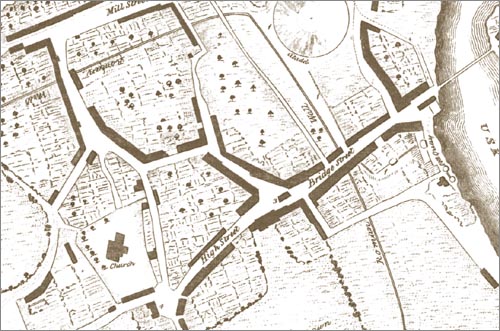
Section of the
plan of Caerleon from Coxe's Historical Tour in Monmouthshire, published
in 1801.
The market hall is indicated by the number 3.
When the Priory came up for auction in 1838 the sales particulars
included a plan (below) which indicated the position of the market
hall.
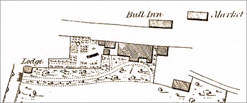
Section of
the plan included in the sales particulars of the Priory in August
1838.
The 1840 Tithe map (below) has the market hall numbered
9a. The apportionment document reveals that it was owned by Sir
Digby Mackworth and 'occupied' by Thomas Gunter, also that its
area was 4 perches - approximately 100 square metres. The building
appears to be twice as long as it was wide making it approximately
14 metres by 7 metres. Thomas Gunter occupied several other properties
including the White Hart Inn and the Round Table (amphitheatre)
field. (See the
1840 Tithe Map of Caerleon and the apportionment.)
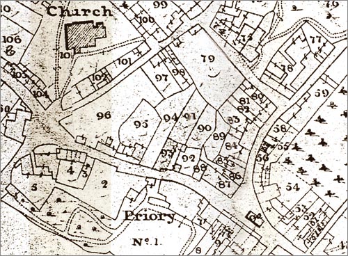
Part of the 1840
tithe map. The market hall is numbered 9a.
Within ten
years of the map above being made the Market Hall was demolished. Drawing of
the Market Hall in 1814 - click here. |