|
Notes
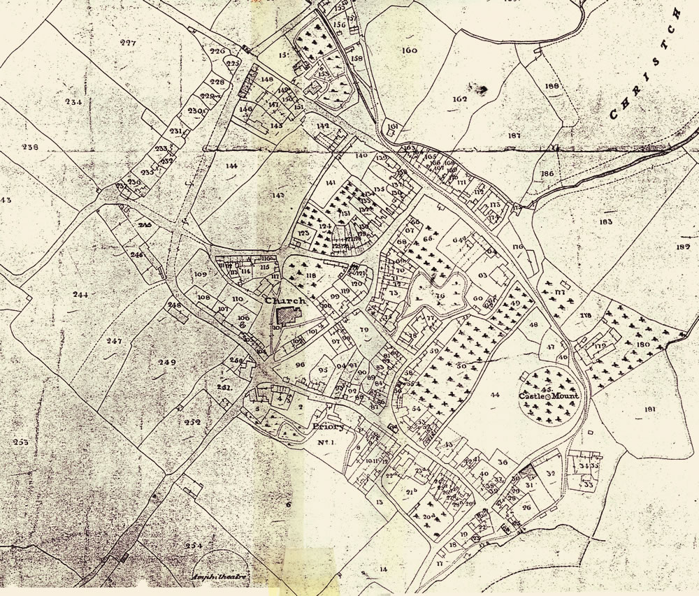
The
1840 Tithe Map of the parish of Llangattock Juxta Caerleon has
each building and plot of land numbered. By referring to the apportionment
one can discover the following details:
The
Landowner
The Occupier
Name and Description of Lands and Premises
State of Cultivation
Area (in Acres, Rods and Perches)
Amount of Rent-Charge Apportioned Upon the Land Payable to Vicar
Amount of Rent-Charge Apportioned Upon the Land Payable to Vicar
Any Other Remarks
The
apportionment is arranged in alphabetical order of the Landowners'
Surnames. Hence finding a particular plot number or occupier involves
delving through the whole document. We have transcribed the hand
written apportionment into a database making the content more
easily accessible:
|
Search the Apportionment Details |
Larger, more detailed map ( 640KB) |
| The Ultra Pontem Area |
Other Monmouthshire Tithe Maps
See also the 1841 Census results for Caerleon. |