|
Notes
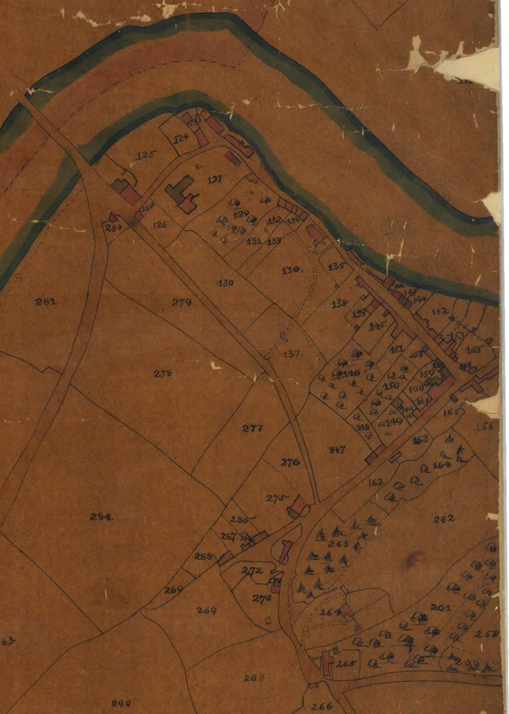
We were delighted to have the opportunity to scan 7 of the 9 sheets of the Christchurch Parish Tithe Map. Thus these maps can be examined online in detail for the very first time. The other two sheets were too large for the scanner. However, the seven maps represent a large portion of the present Newport East of the River Usk. We are most grateful to Newport Community Learning & Libraries for their help with this project.
The
1840 Tithe Map has
each building and plot of land numbered. By referring to the apportionment
one can discover the following details:
The
Landowner
The Occupier
Name and Description of Lands and Premises
State of Cultivation
Area (in Acres, Rods and Perches)
Amount of Rent-Charge Apportioned Upon the Land Payable to Vicar
Amount of Rent-Charge Apportioned Upon the Land Payable to Vicar
Any Other Remarks
The
apportionment is arranged in alphabetical order of the Landowners'
Surnames. Hence finding a particular plot number or occupier involves
delving through the whole document. We have transcribed the hand
written apportionment into a database making the content more
easily accessible. However, please note, we only recorded the details for plots with buildings on them.
Search the apportionment:
| See a Larger Area of the Christchurch Parish |
| See the Caerleon Tithe Map |
Other Monmouthshire Tithe Maps
See also the 1841 Census results for Caerleon. |