|
|
|
|
|
|
WHAT
IS LEFT OF THE TRAMROAD NOW?
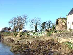
We start our journey by the River Usk. When the tramroad was
constructed the old wooden bridge across the river in Caerleon
was still in use. It was further upriver, the other side of
the Hanbury Arms, from where the stone bridge now stands.
The quayside where the tramroad terminated below the Hanbury
Arms can still be seen. |
|
|
|
|
|
|
|
|
|
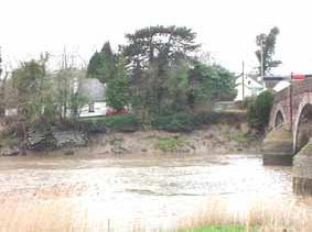
| After
the stone bridge was built, some time around 1810, the tramroad
was extended to the new wharf, some of which can still be seen to
the left of the bridge when approaching from Newport. |
|
|
|
|
|
|
|
|
|
|
|
|
In the book
"The Living Village" by SG Deane, Gordon Bennett, whose
father opened the Hanbury Garage in 1926, recalled that when the
forecourt was excavated to put in petrol tanks they came across
the scales that were used to weigh the trams. Unfortunately nobody
knows what became of the remains of this weighbridge.
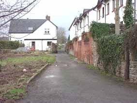
From the River,
the tramroad went behind the houses on Castle Street to join the
end of Mill Street.
|
|
|
|
|
|
|
|
|
|
|
|
|
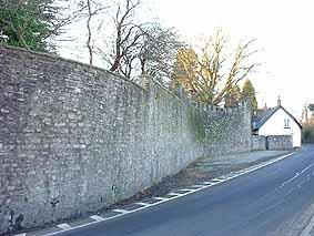
| The
curious curve in the Mynde walls in lower Mill Street may well have
made room for a passing space or parking area. John Jenkins, who
built these walls, was the operator of The Ponthir works and a major
user of the track. |
|
|
|
|
|
|
|
|
|
|
|
|
|
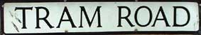
| The
track appears to have actually run in the roadway of Mill Street
until it branched off near the top into what is still named Tram
Road. |
|
|
|
|
|
|
|
|
|
|
| After
crossing the road to Usk, the track followed a level route
to the Caerleon Forge. From
here it ran alongside the Ponthir Road (B4236 with the mill
leat directly beside it. |
|
|
|
|
|
|
|
|
 |
|
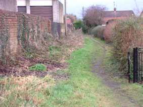
| The
tramroad ran to the left of the mill leat which can just about
be seen amongst the tangle of brambles and trees. |
|
|
|
|
|
|
|
|
|
|
|
|
|
| It
crossed under the road just before Malt House Farm. |
|
|
|
|
|
|
|
|
|
|
 |
|
|
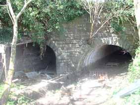
| The
archway on the left was the tramroad underpass the one on
the right carried the mill leat. |
|
|
|
|
|
|
|
|
|
|
|
|
|
|
|
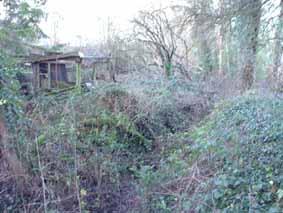
| The
raised ground where the track ran in front of Malt House Farm
can still clearly be seen. (to the right was the mill leat)
|
|
|
|
|
|
|
 |
|
|
|
|
|
|
|
|
| It
crossed the Afon Lwyd before running in front of the Ponthir Works.
Picture of bridge site. Picture of old wall. |
|
|
|
Illustration
bridge site & Ponthir works coming soon. |
|
|
|
|
|
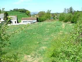
| From
here on its route is now covered by the railway. |
|
|
|
 |
|
|
|
|
|
|
|
|
|
|
|
|
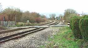
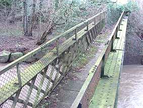
| The
next evidence we find is at Llantarnam. This bridge, now used as
a footbridge, most probably carried the track across the River Afon
Lwyd - though at a spot further South. |
|
|
|
 |
|
|
|
|
|
|
|
| It's
surprising how level the whole route is, with just a gradual climb
all the way. Anyone who follows this route from Ponthir to Llantarnam
for the first time will be amazed how short and easy a route it
is - compared with the hilly and less direct route taken by the
road. A free leaflet available in Caerleon's Tourist Information
Centre, "Walks in Llanfrechfa & Ponthir" (by Torfaen
County Borough), gives details of walks along footpaths in the area. |
|
|
|
|
|
|
|